Routing is an essential component of modern mapping and navigation systems, enabling users to find the shortest or most efficient path between two points on a road network. In this use case, routing was implemented to compute the distance, duration, and shortest path between points of interest in Varanasi, Uttar Pradesh. The ability to determine optimal routes has wide-ranging applications in tourism, transportation planning, and emergency response, making it invaluable for urban management and user convenience.
The dataset used for this project consisted of OpenStreetMap (OSM) points of interest (POI) data, which included various categories such as shops, amenities, historic places, and tourism spots, sourced from the GDI platform. These POIs were first merged into a single dataset and cleaned to create a unified field, “place name,” which contained the names of each point of interest. This allowed for efficient handling of the dataset during the routing process.
For route calculation, the user could select start and end points in several ways. The start point could be chosen from a dropdown list, which is populated with the values from the “place name” field, representing various POIs. Additionally, the start point could be set to the user’s current location or manually selected from the map by clicking on it, which provided the latitude and longitude coordinates. The end point was also selected from the available points of interest from a dropdown list.
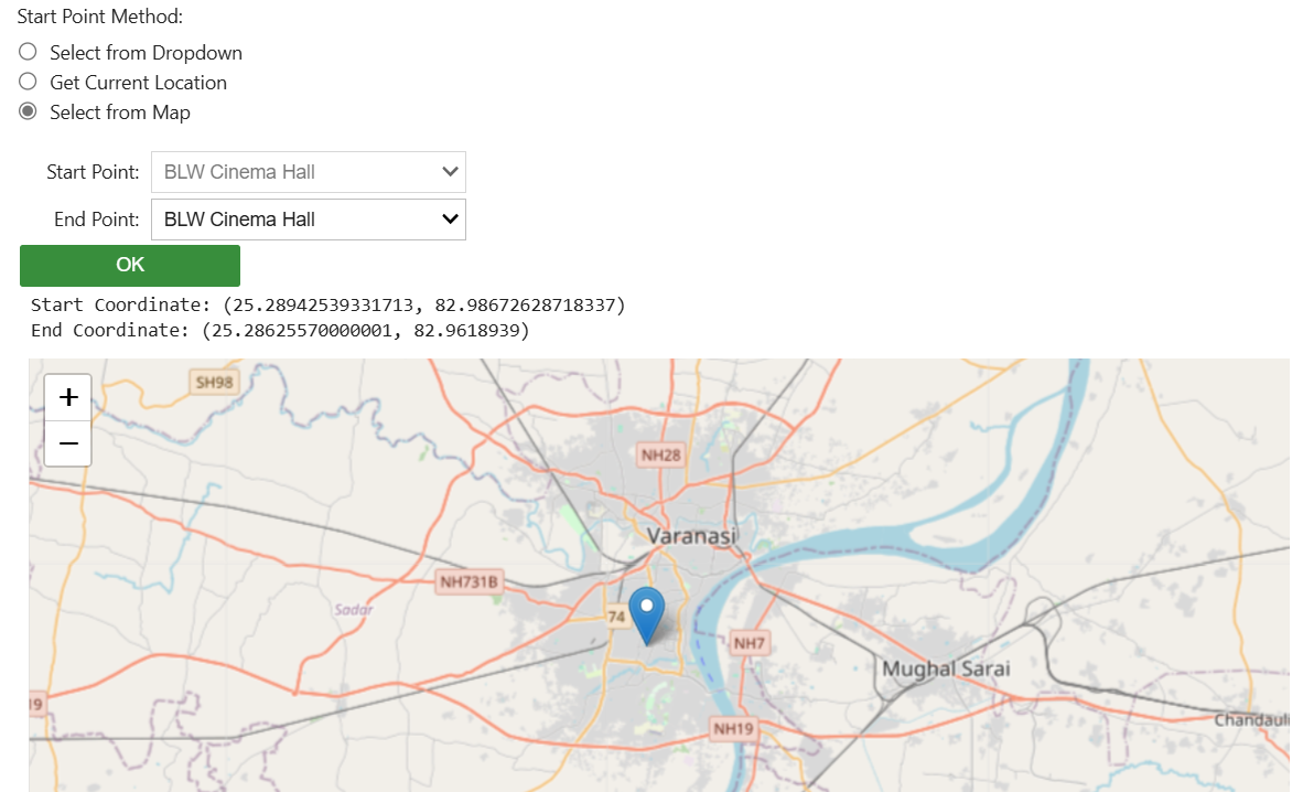
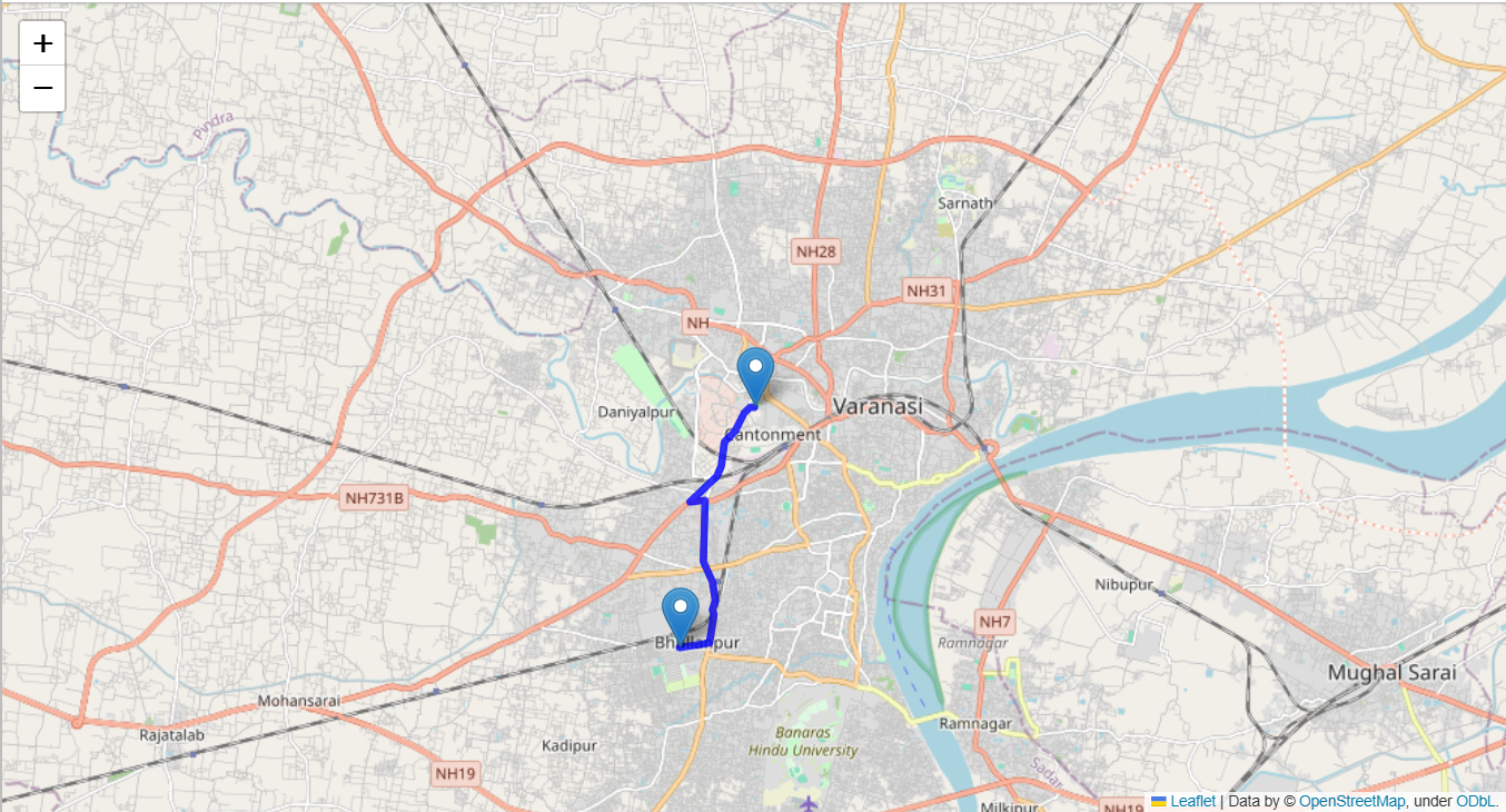
Once the start and end points were defined, the GraphHopper API was utilised to compute the distance, duration, and the shortest path route between the two points. This was done using the graphh Python library, which interfaces with the GraphHopper routing engine. The API response included detailed routing information, which was decoded to display the route on Open Layers, a web-based mapping library.
The insights gained from this simple routing application can be extended to solve more complex routing problems, such as the Traveling Salesman Problem (TSP), which involves finding the most efficient route that visits multiple points and returns to the start. Such complex problems require the same fundamental routing principles but involve optimizing routes across multiple locations.
This routing solution has several practical applications. It can be used in tourism to help visitors navigate between attractions more efficiently, allowing for better trip planning. It also has uses in urban mobility, optimising routes for local transportation and delivery services. Furthermore, in emergency response situations, quick and accurate routing between key locations can be critical in saving time and resources. This use case showcases how integrating routing functionality with local points of interest data can enhance user experience and provide valuable insights for city management and planning.
Related Posts
- CDPG
- November 25, 2021
Bracing to Tackle Urban Flooding With IUDX
Over the years visual imagery around floods in India has undergone a drastic change. Even until ..
- CDPG
- November 5, 2025
Breaking Data Silos: How GDI is Transforming Access to Geospatial Information in India
For years, some of India’s most valuable geospatial datasets remained scattered across govern ..
- CDPG
- September 23, 2021
Enabling Low-Cost Intelligent Traffic Signal System with IUDX
Since decades, traffic signals have been used to regulate traffic in order to increase efficien ..

