


Suitability studies in Geographic Information Systems (GIS) play a vital role in spatial planning and resource management by assessing the appropriateness of a given area for specific land uses based on various criteria. These studies integrate multiple datasets and analytical techniques to evaluate how well certain locations meet predefined requirements, thus guiding decision-making in sectors such as agriculture, urban development, and environmental conservation. By harnessing GIS technology, stakeholders can visualise spatial relationships and make informed choices about land use, ultimately fostering sustainable development.
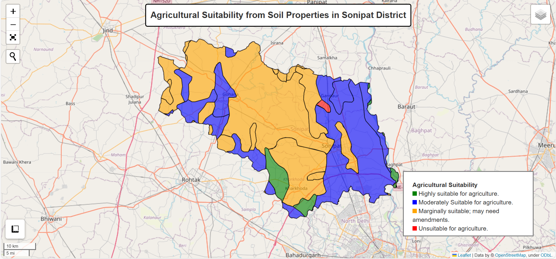
In this context, modelling agricultural land suitability based on soil properties is critical for optimising agricultural productivity and ensuring sustainable land use. Identifying areas where crops can thrive helps farmers and policymakers make informed, data-driven decisions. This use case focused on assessing and mapping land suitability for agriculture in the Sonipat district, leveraging detailed analyses of soil properties data available on the GSX platform.
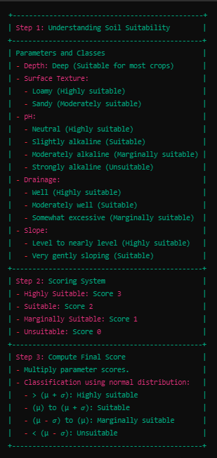
The methodology involved evaluating key soil properties, including depth, surface texture, pH levels, drainage capacity, and slope. Each property was assessed for its impact on agricultural suitability and assigned a score based on its value. These scores were then combined across all layers, with a final score computed by multiplying the values for each property. The final scores were normalised to fit a normal distribution and classified into four categories: highly suitable, suitable, marginally suitable, and unsuitable for agriculture.
Once the classification was complete, the final land suitability map was displayed on Leafmap with a legend for easy visualisation. The map provides a clear representation of the varying levels of agricultural potential across Sonipat, highlighting the most productive areas as well as those that may require intervention or should be reserved for other uses.
This modelling approach offers numerous benefits. By identifying the most suitable areas for farming, land use can be optimised, ensuring that high-quality agricultural land is put to productive use. The model also promotes sustainable agriculture by helping to enhance crop yields while reducing environmental impact. For instance, by identifying areas that naturally support healthy crop growth, the need for fertilisers and chemical inputs can be minimised. Additionally, the suitability map provides farmers with valuable insights, enabling them to make data-driven decisions that support both economic and environmental goals. Ultimately, this use case demonstrates how modern technology and soil data can be leveraged to promote sustainable, efficient, and productive agricultural practices.
Related Posts


