


Why Data Quality Feedback Matters
Geospatial data powers critical decisions in urban planning, disaster management, environmental monitoring, and infrastructure development. Whereas, poor quality geospatial data can result in flawed analysis, misguided policy decisions, and wasted resources. Traditional metadata documentation provides producer-declared quality metrics, but it rarely captures the user’s experience when actually working with the data. The GDI feedback mechanism bridges this gap by creating a two-way dialogue between data consumers and providers. Users who download and work with datasets can report specific quality issues they encounter, while providers gain actionable insights into how their data performs in real-world applications.ISO 19157-Aligned Quality Framework
The GDI feedback mechanism is built upon ISO 19157, the international standard for describing geographic information quality. The system provides separate questionnaires for vector and raster data, covering six core quality elements.For Vector Data (32 quality checkpoints):
- Completeness: Missing spatial features, unrealistic objects, incomplete attributes, or duplicate geometries
- Logical Consistency: Incorrect domain values, inconsistent formats or CRS, topological errors like gaps and overlaps
- Positional Accuracy: Misalignment with reference basemaps, inconsistent relative positions between features
- Thematic Accuracy: Wrong classifications, outdated attributes, incorrect quantitative values
- Temporal Quality: Missing timestamps, inconsistent observation dates
- Usability: Missing metadata, unsupported formats, extensive preprocessing requirements, unclear licensing
For Raster Data (26 quality checkpoints):
- Completeness: No-data gaps, falsely classified pixels, missing metadata, incomplete spatial extent
- Logical Consistency: Invalid value ranges (NDVI beyond -1 to 1), incorrect band structure, format inconsistencies
- Positional Accuracy: Pixel misalignment with reference data, large displacement, distortions across tiles
- Thematic Accuracy: Misclassification errors, quantitative values exceeding physical limits
- Temporal Quality: Missing or wrong timestamps, temporal inconsistencies in multi-temporal datasets
- Usability: Incomplete metadata, corrupted files, missing classification legends, inadequate resolution, data discovery difficulties
How the System Works
Each resource item in the GDI catalogue can be evaluated by a consumer driven feedback mechanism, through which consumers can submit issues related to that dataset. Once an issue is resolved by the provider, its status is updated to “resolved” and this change is reflected at the consumer’s end. For every resource item in the catalogue, the feedback icon enables a view that shows the total number of issues raised, how many users have raised them, and the detailed list of issues reported, along with a time‑series plot of the number of issues against date that indicates when issues were created, how many were raised on each date, when they were resolved, and how many were closed over time.User Feedback Submission
The feedback submission process in the GDI catalogue is initiated by consumers. In the feedback tab of the consumer panel, click on ‘new feedback’ option and the users first select the resource group and specific resource item (dataset), then choose from predefined data quality issues aligned with ISO 19157 standards, including sub-issues. Next, they can provide additional details for the selected issue, such as image attachments and comments, before submitting with their consumer information. The panel also features a feedback history tab that displays all raised issues along with their resolution status.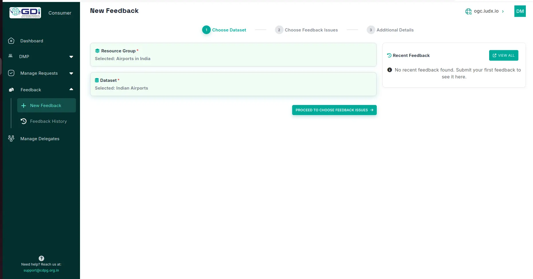
Figure 1 a. Consumer panel enabling user to select the data to give feedback
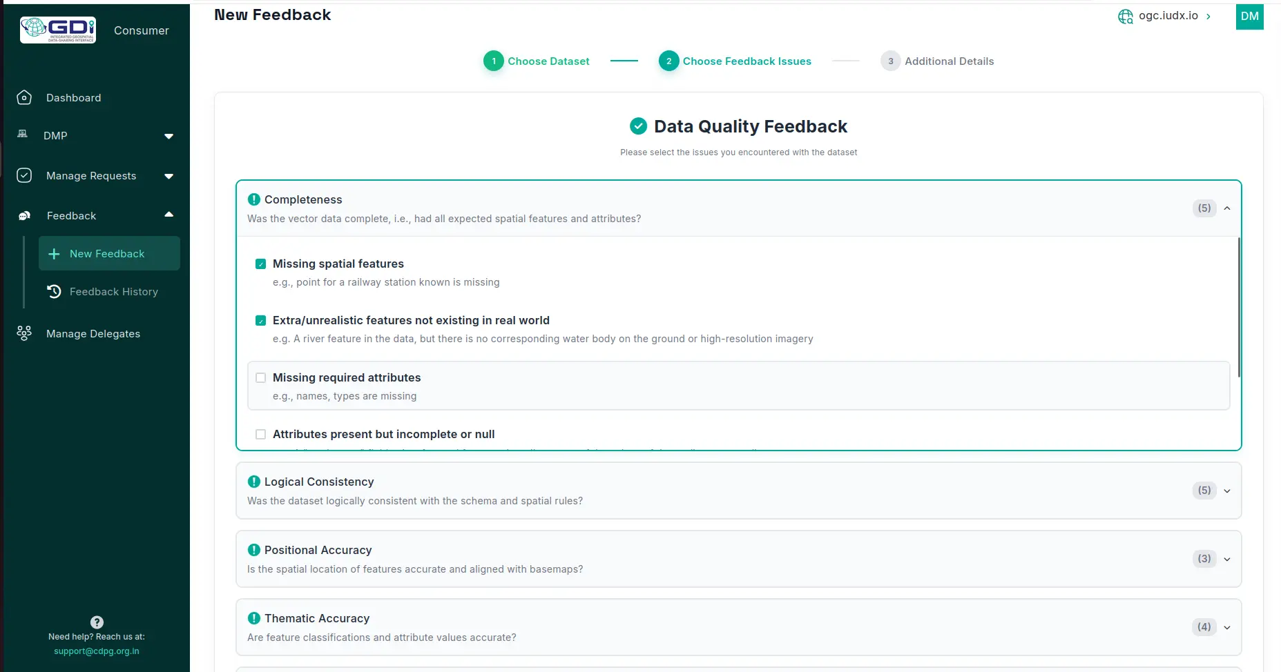
Figure 1 b. Interface showing predefined data quality issues and its sub issues defined based on ISO 19157
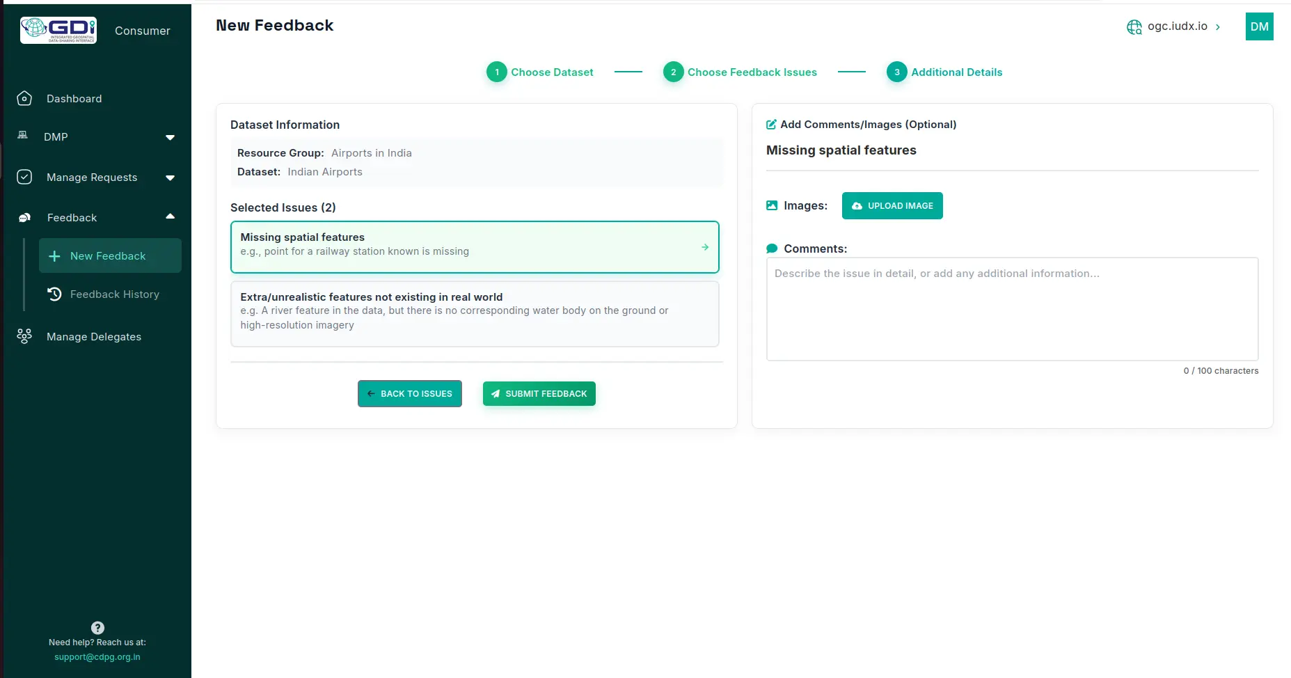
Figure 1 c Feedback Interface that enables user to add images and give additional comments for each issue
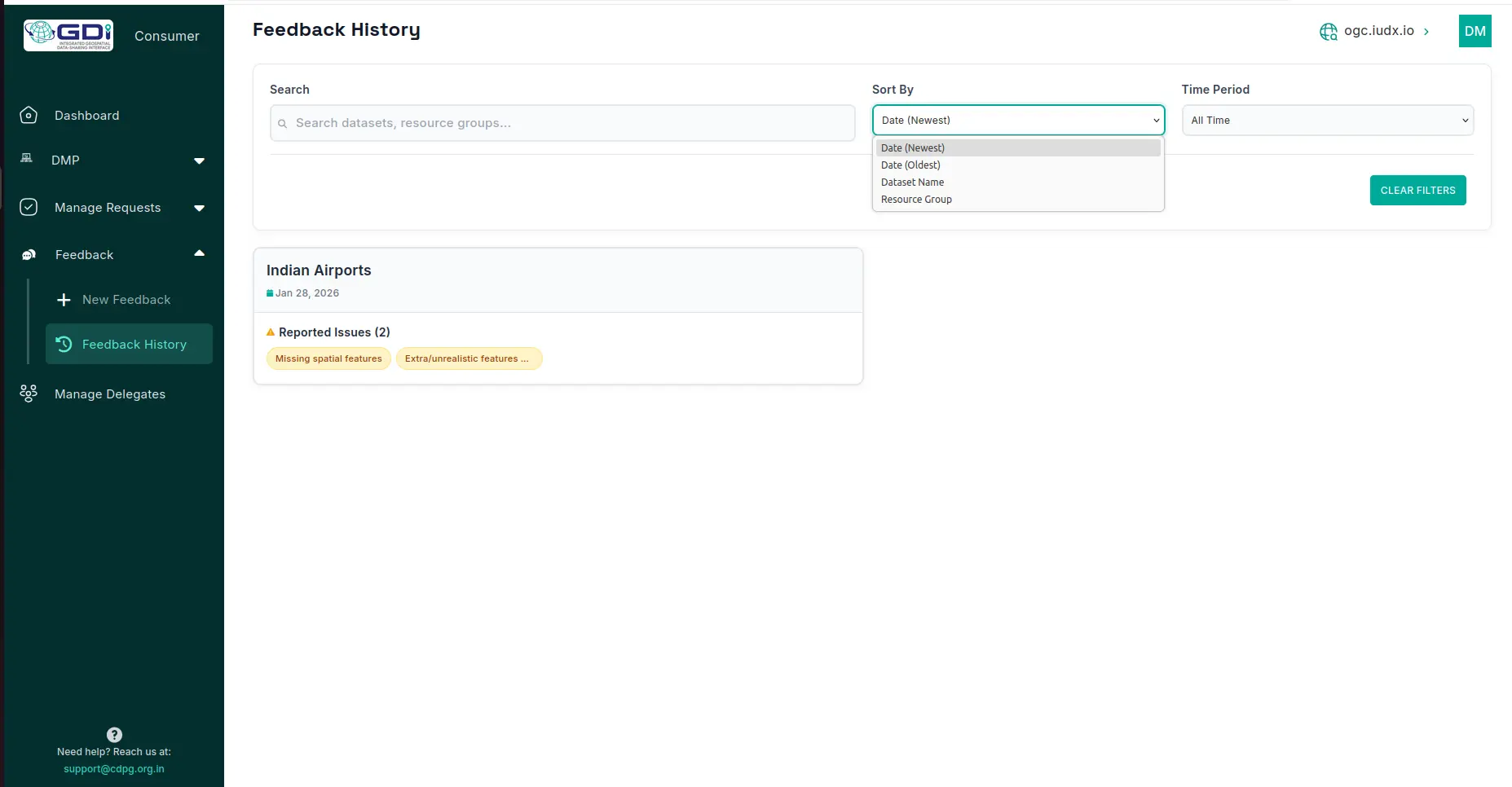
Figure 2 a. Feedback history with list of datasets for which issues are raised by consumer
Provider Dashboard and Resolution
The provider dashboard facilitates efficient feedback resolution for reported data quality issues in the GDI catalogue. In the feedback tab, resource items (datasets) with raised issues are listed at the resource item level. Clicking a dataset reveals details on reported issues, sub-issues, and the consumer who raised them, while selecting an individual issue displays additional information such as comments and attached images.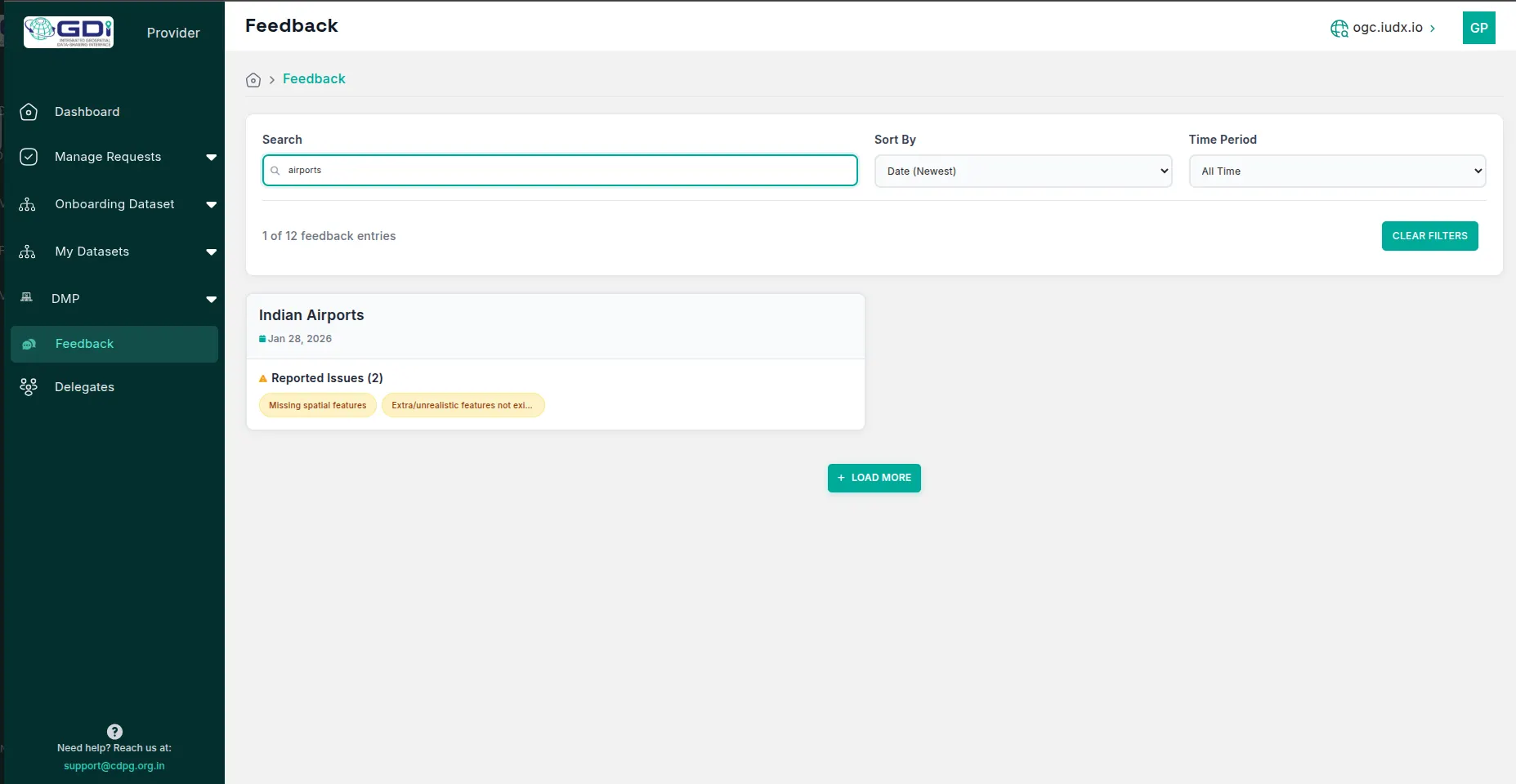
Figure 3. Provider panel showing list of data for which consumers raised issues.
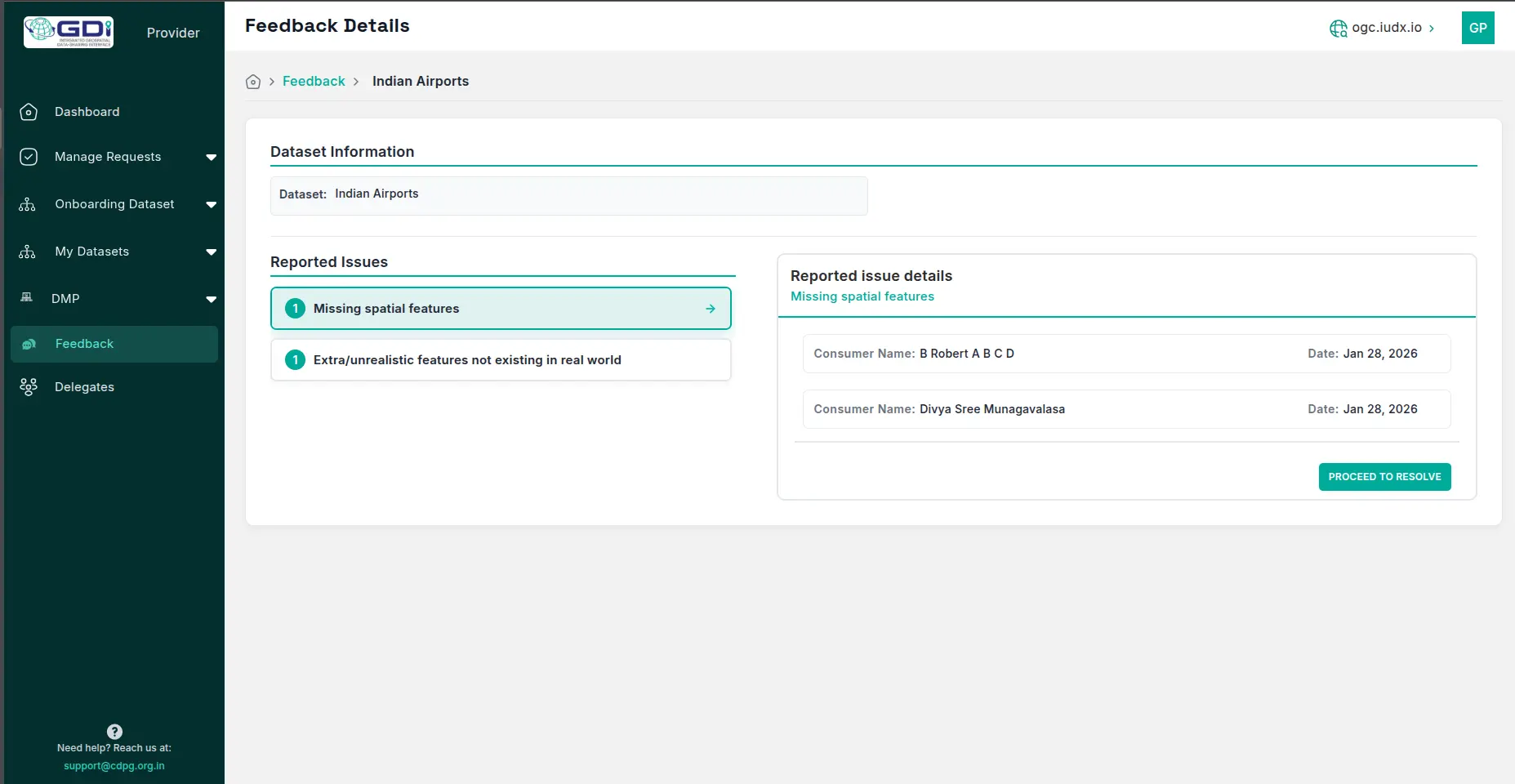
Figure 4. Interface with information on the details of the issue and consumer who raised issue
To resolve an issue, providers click “Proceed to Resolve” for each one individually, add a required comment in the dialog, and confirm resolution. Successfully resolved issues are removed from the provider panel, while at the consumer end, the feedback history updates to show a “resolved” status for each affected issue.
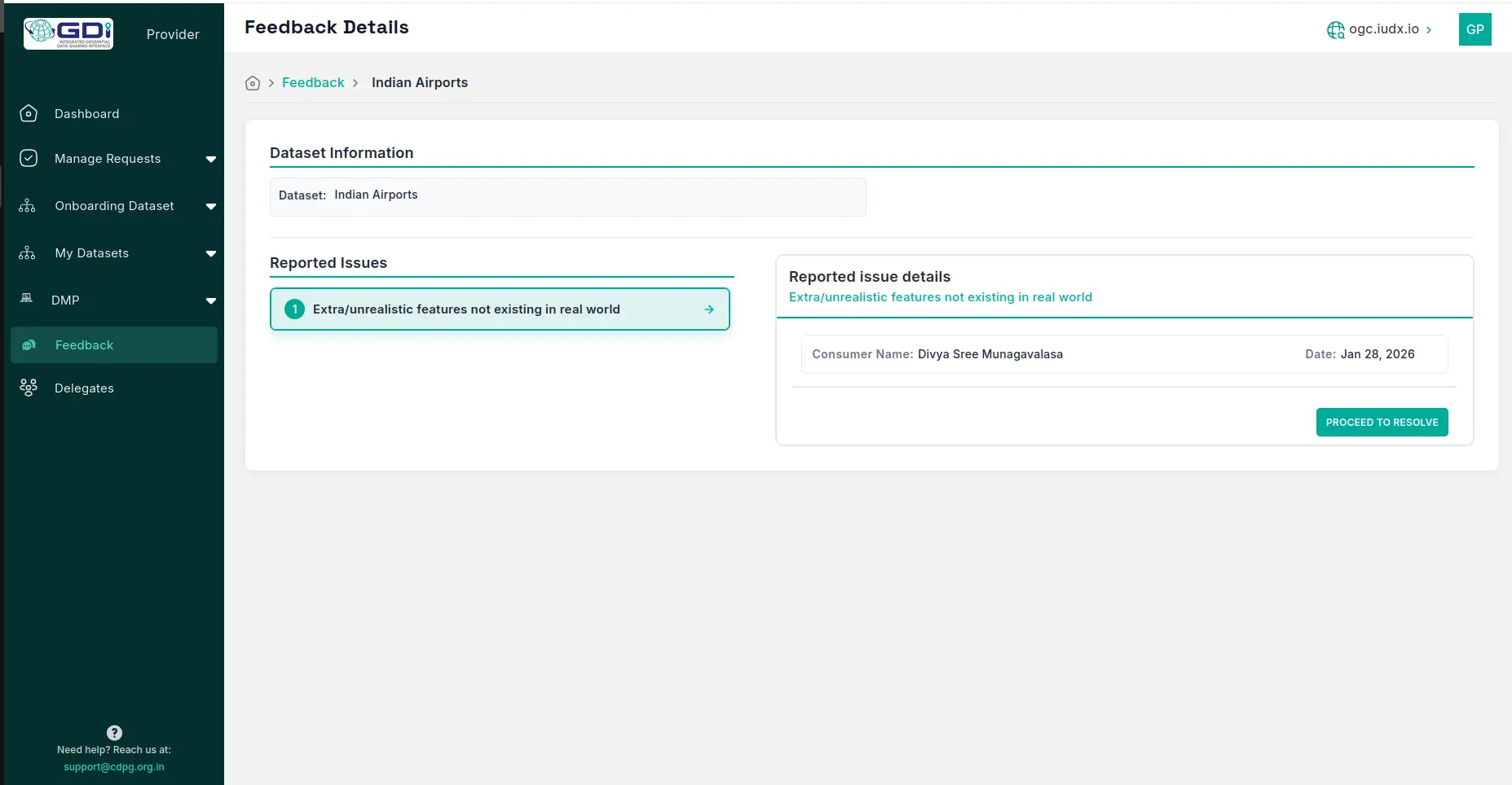
Figure 5. Provider panel enabling “Proceed to Resolve” button to resolve issues
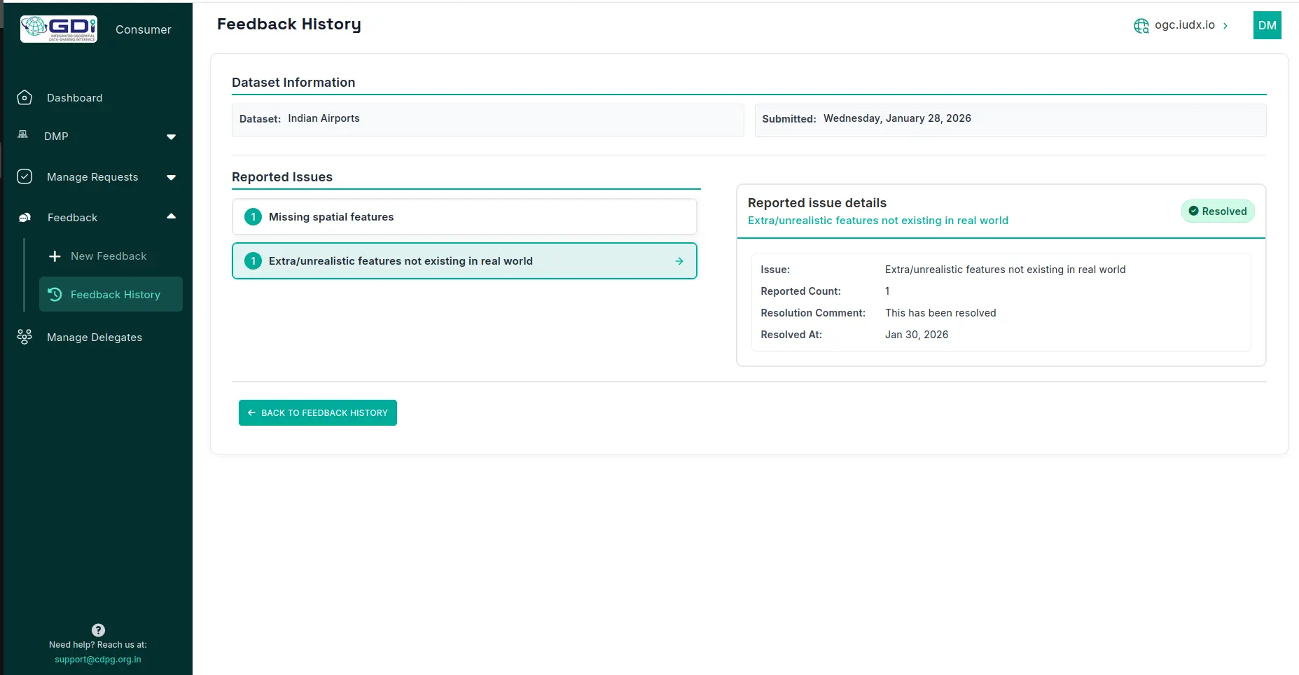
Figure 6. Consumer panel after feedback resolution with resolved status for the issue
Benefits for the Geospatial Ecosystem
- Potential users review quality feedback before downloading datasets, making informed decisions about data fitness for their project requirements. This reduces wasted effort on unsuitable data.
- The feedback mechanism creates accountability for data providers to maintain high standards. Datasets with poor reviews are naturally avoided, while high-quality datasets gain recognition and wider adoption.
- By structuring feedback around ISO 19157 elements, GDI establishes a common language for discussing data quality across diverse communities. This standardization facilitates cross-dataset comparison and promotes best practices in data production.
- User feedback reflects real-world performance across diverse use cases, providing richer quality information than producer-declared metrics alone. This crowdsourced validation captures issues that may not appear in controlled testing environments.