


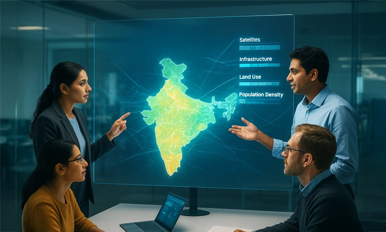
For years, some of India’s most valuable geospatial datasets remained scattered across government departments, research institutes, or private organizations. They held immense potential to transform logistics, strengthen climate resilience, and support smarter urban planning, but they remained difficult to access, buried in different formats and lacking interoperability.
Recognizing this challenge, the Government of India through the Department of Science and Technology (DST) tasked the Centre of Data for Public Good (CDPG) at the Indian Institute of Science (IISc) with a bold vision: to develop a standards-based geospatial data exchange platform. The result was the Integrated Geospatial Data Exchange Interface (GDI) – a unified, open-access system built on OGC APIs, designed to make metadata-rich, analysis-ready geospatial data available for application developers, researchers, startups, and policymakers alike.
From siloed datasets to a national exchange
Designed to treat publicly funded geospatial data as a common good, GDI has established itself as a unified, open-access platform for interoperable, consent-based, analysis-ready, and metadata-rich data exchange using globally accepted standards. As a digital public infrastructure, it enables seamless sharing of geospatial data, accelerating applications in data science and empowering developers.
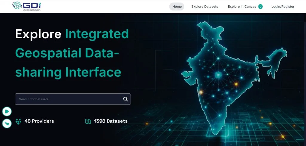
GDI catalogue(catalogue.geospatial.org.in)
Unlike traditional open data portals, GDI emphasizes secure, consent-based data sharing, where data providers retain control over how their datasets are accessed and used. Robust auditing mechanisms ensure transparency and accountability, while an integrated analytics engine allows performing basic operations on the data without always downloading raw datasets. The platform is also capable of onboarding large volumes of data and supports fine-grained access control for different user groups. By adhering to OGC standards, GDI ensures interoperability and fosters collaboration by allowing value-added services like Sandbox, visualization, and application development. In doing so, GDI enables an ecosystem that drives trust, innovation, and responsible use of geospatial data. To achieve these goals, CDPG developed a new GIS server based on the latest OGC API Standards with the Intelligent Universal Data Exchange (IUDX) platform at its core – a technology stack developed in-house.Unlocking access to 1300+ datasets
The platform’s rapid adoption is a testament to its success, with GDI already unlocking access to more than 1300 datasets. Contributors include national agencies such as the Survey of India, the National Remote Sensing Centre, and the National Informatics Centre; academic partners such as the Indian Institute of Space Science and Technology, and the Interdisciplinary Centre for Water Research; and industry players including IdeaForge, Thazhal, Neoperk, and Niruthi. By harmonizing formats (from shapefiles and GeoTIFFs to REST APIs), and providing standardized access via the OGC APIs, GDI removes barriers that kept data siloed earlier. Vector data is also converted to GeoPackage format, enabling easier downloads of large datasets.Real-world impact
The platform is already enabling organizations across sectors to do proof of concepts and prototypes:- Logistics: Delhivery, India’s largest third-party logistics provider, incorporated GDI’s village polygon data for Varanasi. The result was a 2% increase in field executive efficiency, and a 10% improvement in geocoding accuracy for rural Varanasi.
- Renewable energy: Bangalore-based SIRPI Analytics developed a web application that combines Copernicus wind datasets (a collection of open and free data) with the Survey of India boundaries through GDI’s secure, standards-based platform. The tool helps visualize wind speeds, estimate potential energy output, and identify regions with high wind potential.
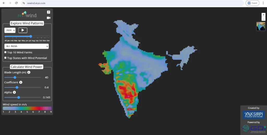
Exploring wind patterns using data available through GDI
- Coastal monitoring: Thazhal Geospatial Analytics, in collaboration with CDPG, developed a visual analytics platform to track urban sprawl along India’s 7,500 km coastline from 1985 to 2015. The application combines GDI datasets with high-resolution building footprint data from the World Settlement Footprint Evolution (WSF-Evo) to map patterns of coastal urban expansion.
Beyond these applications, GDI is also a technology partner for Operation Dronagiri, a flagship initiative under India’s National Geospatial Policy (NGP), led by the Geospatial Data Promotion and Development Committee (GDPDC). This initiative demonstrates the impact of geospatial solutions across key sectors such as agriculture, transportation, infrastructure, as well as livelihoods and skilling, with 25 startups across five Indian states.
GDI has also collaborated with industry partners like Hexagon, with an integration made possible by OGC standards – a partnership that emerged from the OGC Code Sprint (India node) hosted by CDPG.Technical foundation
To deliver its services, GDI relies on the following OGC API Standards:- OGC Features API – for accessing vector data
- OGC Tiles API – for visualizing raster and vector data as base maps
- OGC Coverage API – for accessing coverage data
- OGC Processes API – for onboarding, vector tile generation, and administrative tasks
The GIS server implementing these standards can be found at https://geoserver.dx.geospatial.org.in.
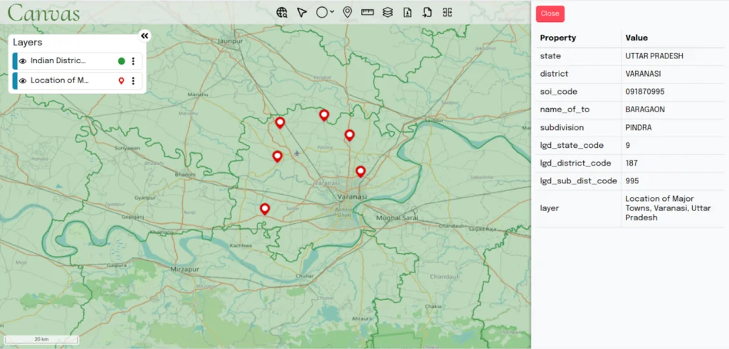
Alongside these standards, the platform implements the SpatioTemporal Asset Catalogue (STAC), making it easier to find, index, and share assets such as satellite imagery across space and time. The STAC server can be found at https://geoserver.dx.geospatial.org.in/stac. GDI also integrates tools like PostGIS, GDAL, OGR FDW, and Multicorn for data management and onboarding. For visualization, CDPG developed Canvas, a browser-based platform using OpenLayers, and a QGIS plugin for advanced analysis. A list of the APIs served by the various components of GDI can be found at https://dx.geospatial.org.in/apis.
GDI Canvas (https://canvas.geospatial.org.in)